
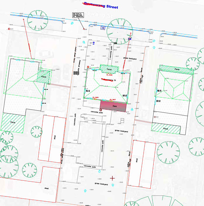
Aplus Survey Group provides highly accurate detail and contour surveys to capture every key feature and elevation of your site.
Our surveys map natural landforms, existing structures, services, trees, boundaries, and surface levels with precision, giving architects, engineers, and builders the reliable data they need for planning and design.
Whether for residential projects, commercial developments, or large-scale subdivisions, we deliver clear and comprehensive plans showing ground contours, spot levels, and all visible site features.
With advanced equipment and experienced licensed surveyors, Aplus Survey Group ensures your project starts with the most accurate and up-to-date information for efficient approvals and successful construction.
What Does a Feature & Level Survey Include?
While every site is different, typical deliverables include:
- A site plan showing all visible features (buildings, trees, fences, retaining walls, driveways, services)
- Contour lines and spot height labels across the site
- Levels of adjacent buildings and features within a prescribed distance (often 9 m to boundaries) including head/sill heights of windows, eaves, ridges, gutters, parapets
- Location of utility services that are visible / accessible
- Road, nature strip, crossovers, kerb details along the frontage
- Establishment of a temporary benchmark (TBM) or connection to a known height datum (e.g. Australian Height Datum) to set the vertical reference.
- Where necessary, features on neighbouring properties (within certain distances) to satisfy planning constraints
Depending on site size and complexity, the survey may be carried out via total stations, GPS, laser scanning, or even drones.
How the Process Works
- Scope & Planning
The surveyor liaises with you or your designer to understand which features and levels are needed, survey extent, and required detail. - Field Data Collection
The survey team visits the site, measures elevation and feature data, often connecting to known control points or benchmarks. - Processing & Drafting
The raw measurements are processed and compiled into a CAD or GIS-based plan, complete with contours, spot levels, feature symbology, and annotations. - Delivery & Integration
The survey plan is delivered (often in AutoCAD/DWG, PDF formats) and provided to architects, engineers, and council for use in designing and permitting. - Updates (if needed)
If the site changes (e.g. excavation, demolition), further surveys may be done to reflect updated conditions.
Challenges & Considerations
- Access & visibility limitations (dense vegetation, fences, structures) may restrict what can be reliably measured.
- Site complexity (steep slopes, uneven terrain) increases the time and cost of surveys.
- Datum & vertical reference consistency: It is essential that the survey is tied to a known height datum (e.g. AHD in Australia) to maintain consistency with other disciplines.
- Neighbouring property features: Getting permission or accurate data from adjoining sites can be a challenge, but is often necessary for regulatory compliance.
- Timeliness: Construction or demolition works, or weather events, can alter site conditions after the survey; repeating data capture may be required if the schedule is prolonged.